

Our work, as our subscribers see it.
SARI Global builds the dashboards, alerts, reports and training that NGOs, embassies and inter-governmental organisations use to move safely through Lebanon, Syria, Nigeria, Palestine and Yemen. This is what the work looks like.
STRAT-i dashboards
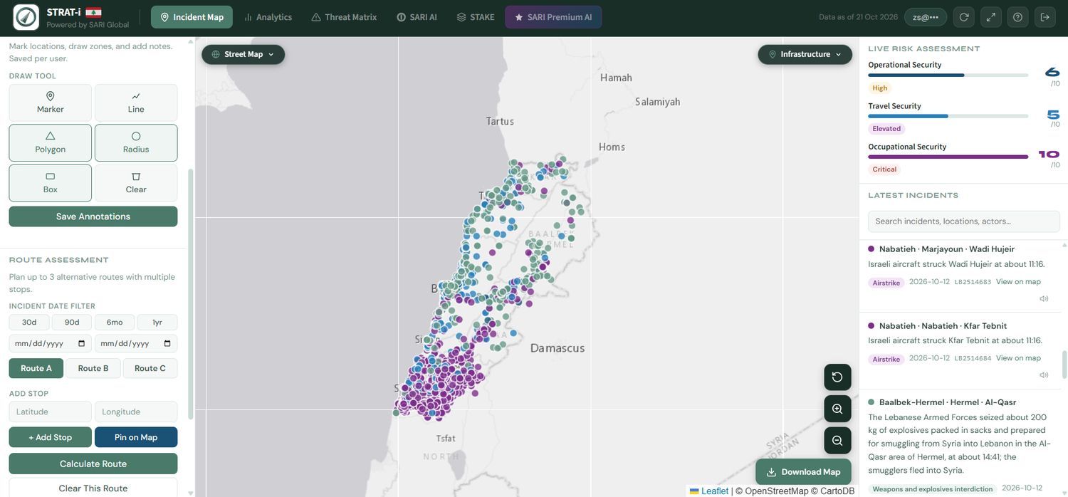
See where it happened, and how bad it is now.
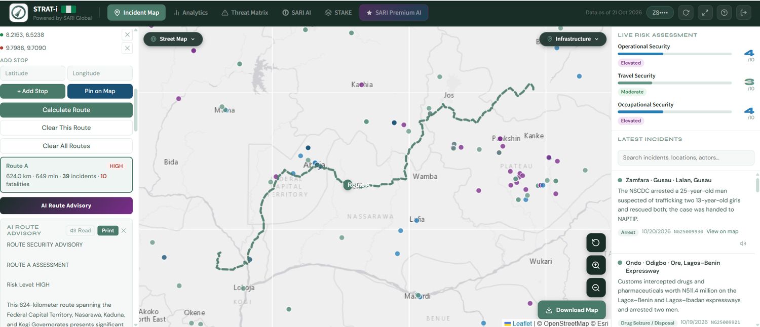
Every verified incident is placed to district level and coloured by category. A live risk assessment scores operational, travel and occupational security out of ten for whatever area is on screen.
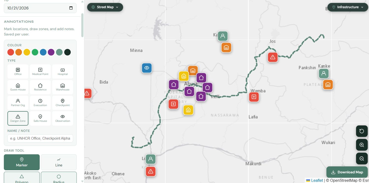
- Draw a polygon, radius or box to filter the map to one area
- Latest incidents with category, date and reference
- Save annotations per user
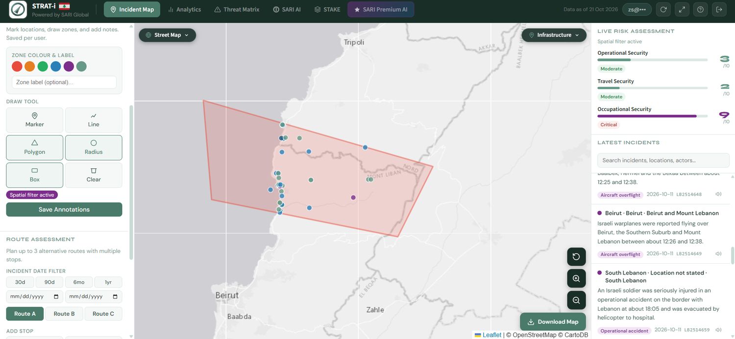
Layers that explain the ground.
Switch the basemap to satellite or Sentinel-2, and turn on active fires, standing water and flooding, heat and drought stress and earthquakes. Infrastructure overlays add hospitals, airports, border crossings, police and military sites, seaports and fuel stations.
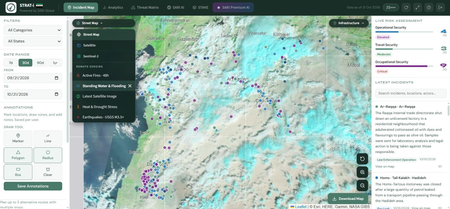
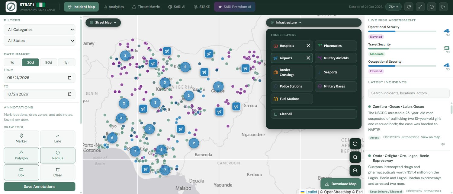
Plan a journey against the incident record.
Plan up to three alternative routes with multiple stops. Each route returns its distance, time, the incidents and fatalities along it, a risk level and an AI route advisory that can be printed for the team.
Patterns first, then the ranking.
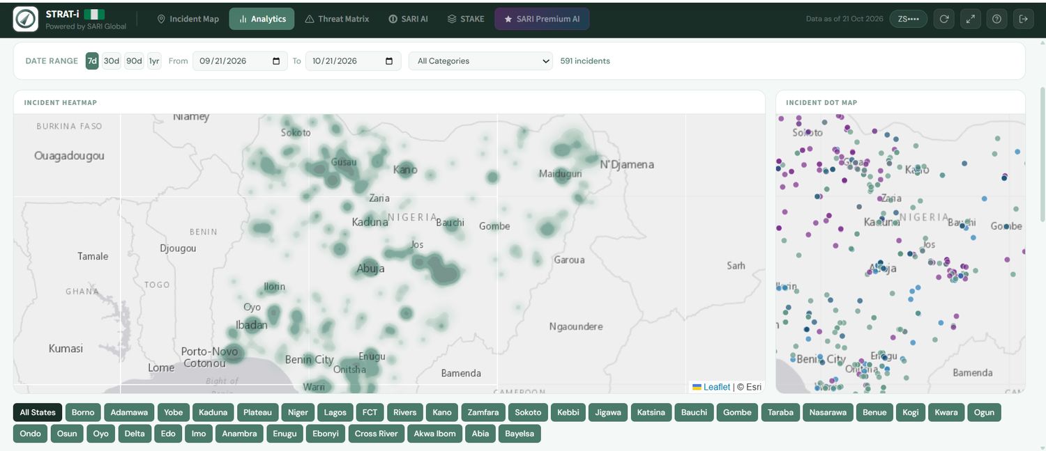
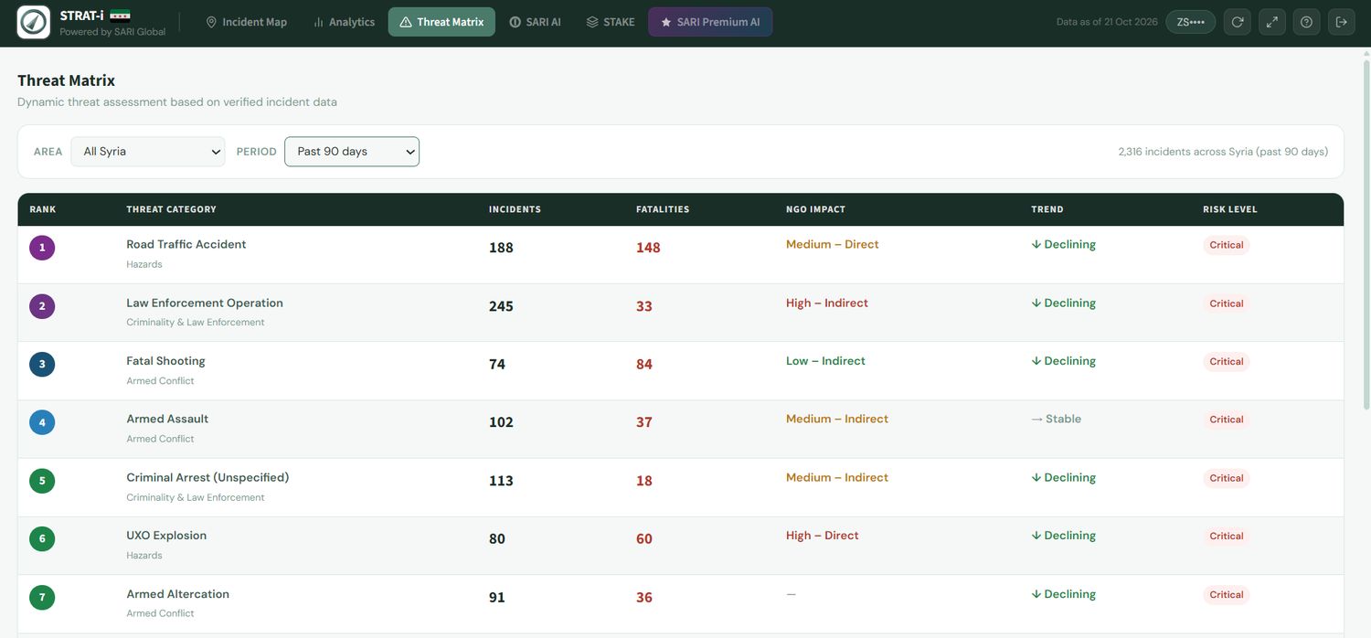
Heatmaps and dot maps by date range and state show where activity concentrates. The threat matrix ranks threat categories by incidents, fatalities and effect on NGO operations, with a trend and a risk level for each.
Know who is acting, and which way they are heading.
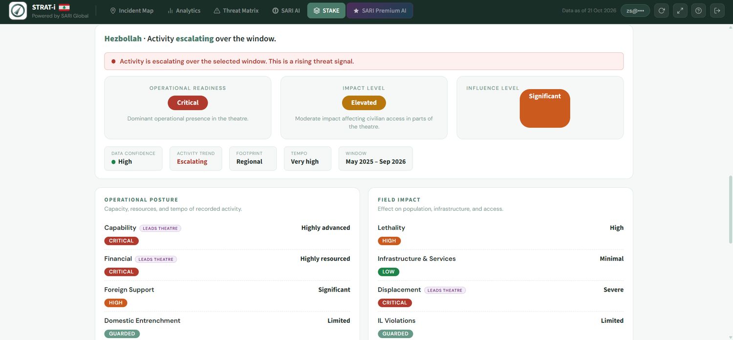
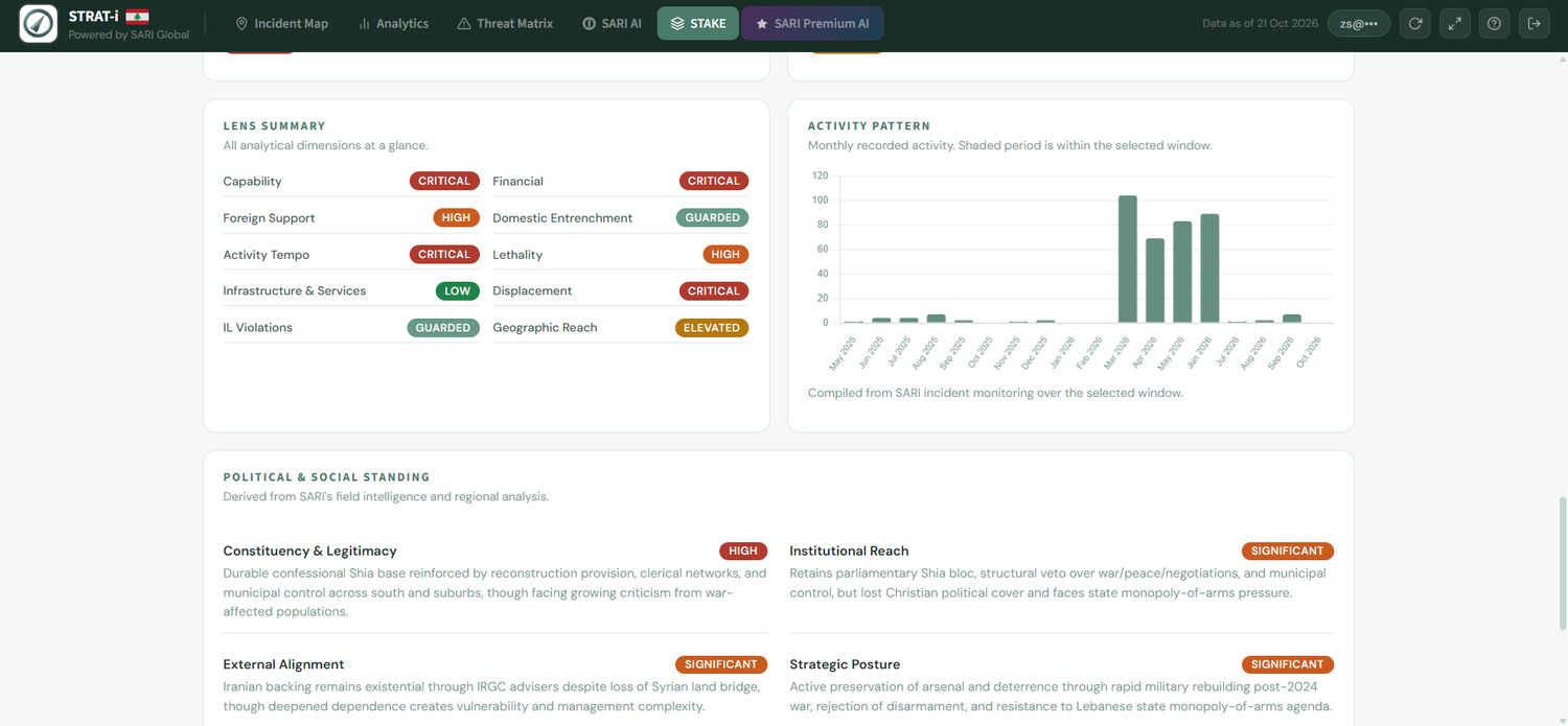
Actor profiles score capability, financing, foreign support, lethality, displacement and geographic reach, then show the activity pattern month by month and the actor's political and social standing.
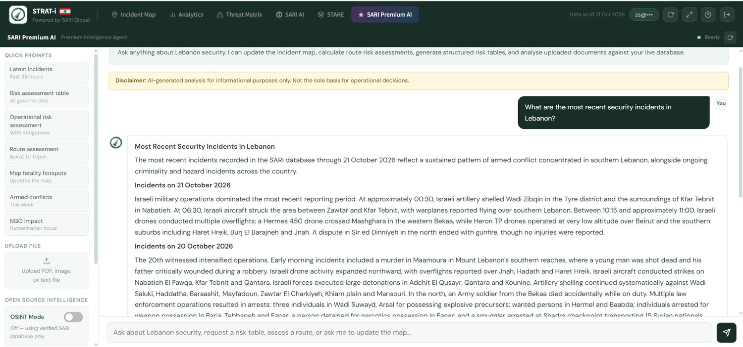
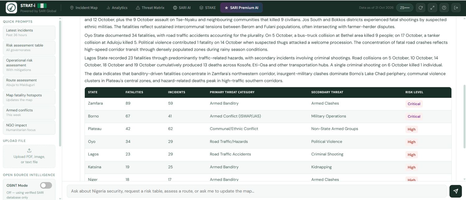
Ask the register a question and get a brief you can use.
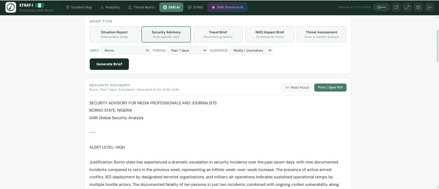
The AI analyst answers from SARI's verified database, builds risk tables, assesses routes and updates the map. A separate brief generator writes situation reports, security advisories, travel briefs, NGO impact briefs and threat assessments for a chosen area, period and audience.
SARI Alerts
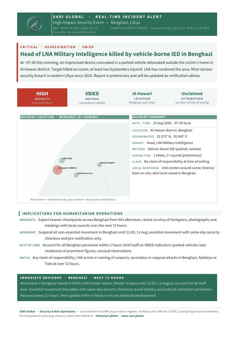
Incidents logged by the GSOC are pushed to subscribers for the countries and incident types they choose, even with the app closed. Each alert opens to a 12 hour feed and a live map. It runs in the browser on Android and iPhone, with no app store.
Illustrative screens. Alerts can be updated after sending as verification continues.
Reports
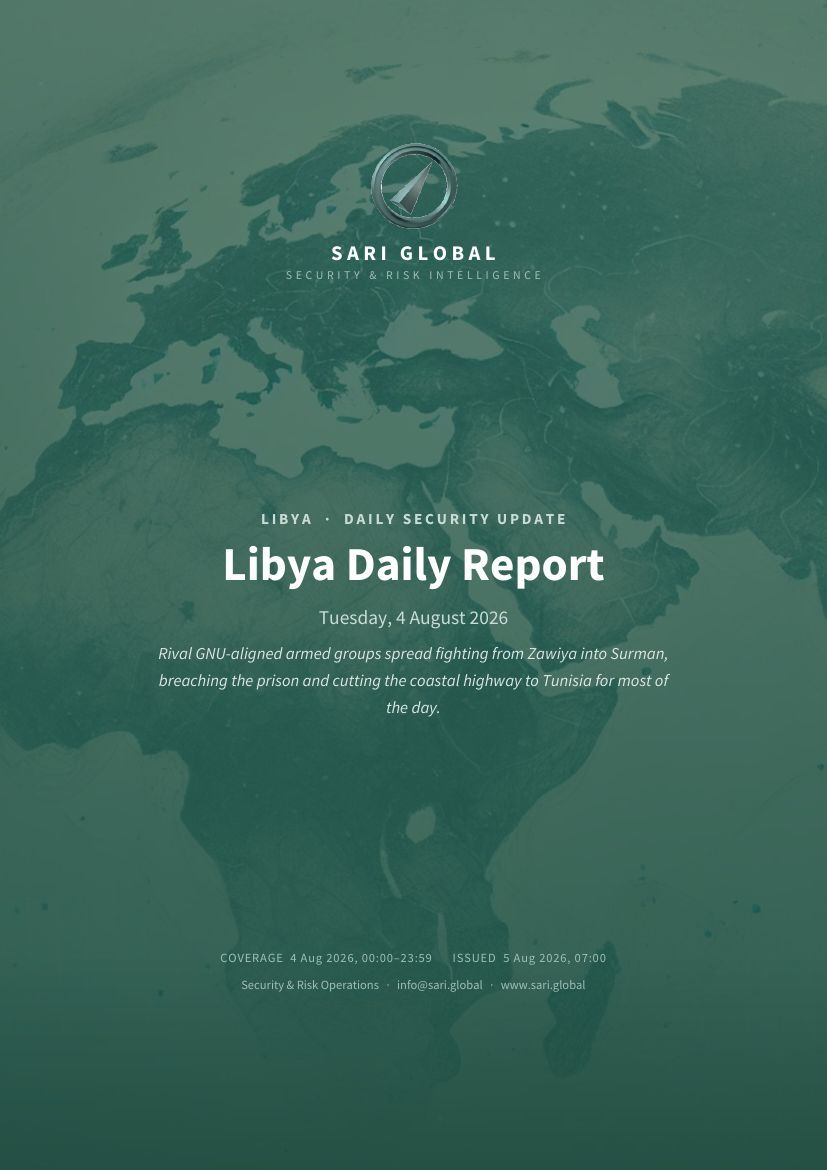
Daily Security Updates
Same-day incident round-ups organised by governorate or region.
Weekly Reports
The week in review with incident statistics, trends and a forward look.
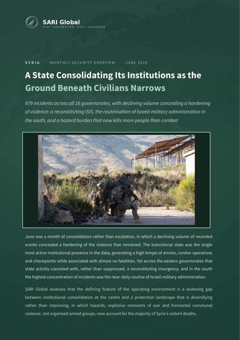
Monthly Reports
A strategic synthesis of threat shifts and longer-range patterns. Monthly reports lead with a judgement.
Flash and Spot Alerts
Immediate notices on critical events, backed by round the clock monitoring.
Access is by subscription or trial. Coverage varies by country.
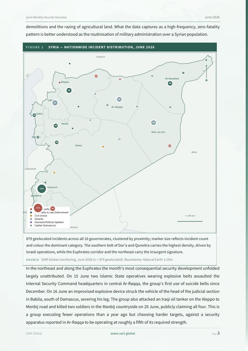

161 incidents, 12 confirmed deaths, and the highest Israeli tempo of the post-MoU period.
Israeli forces initiated 92 operations, 57 percent of the week, concentrated in Nabatieh and paired with a systematic burning of border housing that signals consolidation, not withdrawal.
- Key figures and headline assessment
- Data analysis and weekly overview
- Charts and nationwide incident map
- Geographic overview with operational implications
- Trend analysis
- Humanitarian outlook and risk matrix
- Strategic recommendations

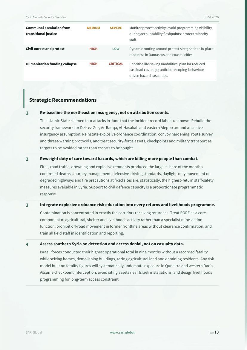
154 incidents, 19 deaths, and a strike that sharpened the Turkiye-Israel contest.
A high-volume, low-lethality week. An 18 August Israeli airstrike on the Abu al-Duhur airbase escalated the competition over post-Assad Syria, while the completion of SDF integration marked a milestone in central consolidation.
- Key figures and headline assessment
- Data analysis and weekly overview
- Charts and nationwide incident map
- Geographic overview with operational implications
- Trend analysis
- Humanitarian outlook and risk matrix
- Strategic recommendations

154 incidents, 116 deaths, and at least 189 people abducted.
ISWAP's internal strain did not reduce its reach across Borno, Yobe and Adamawa, while mass abductions continued across the North West and Niger State.
- Key figures and headline assessment
- Data analysis and weekly overview
- Charts and nationwide incident map
- Geographic overview with operational implications
- Trend analysis
- Humanitarian outlook and risk matrix
- Strategic recommendations

119 incidents, 102 deaths, and a sharp rise in Houthi strike lethality.
Two Houthi mass-casualty strikes on 6 August, against Nation's Shield camps in Hadramawt and against Marib, killed some 45 and drove the week's toll.
- Key figures and headline assessment
- Data analysis and weekly overview
- Charts and nationwide incident map
- Geographic overview with operational implications
- Trend analysis
- Humanitarian outlook and risk matrix
- Strategic recommendations

A shift to targeted aerial attrition, and a cascade of infrastructure failure.
Both the Sudanese Armed Forces and the Rapid Support Forces have shifted toward unmanned aerial attacks on leadership nodes, medical infrastructure and logistical hubs, while economic contraction and strikes on electrical grids deepen the humanitarian collapse.
- Executive strategic summary with a risk heatmap
- Comprehensive biweekly overview
- Geographic deep dive: Khartoum, the Darfurs and the Kordofans
- Deep-dive trend analysis
- Operational risk assessment
- Strategic recommendations
The live weeklies also carry an interactive incident map. Maps are left out of the page previews.
Situational Reports (SitReps)
Deep dives issued when an event demands one, with geospatial mapping, timelines and recommendations.
Thematic and Strategic Reports
Analysis of a single theme, with scenario planning and forecasting.
Our published situational and thematic reports are on Insights. A selection:
Read all published analysis on Insights →
Area Security Risk Assessments
Location specific threat and access evaluations.
Risk Assessments
Threat, vulnerability and likelihood analysis for a specific operation.
Journey Management Plans
Route, checkpoint and communications planning.
Due Diligence and Crisis Support
Partner vetting, pre-crisis planning and real time crisis guidance.
Prepared for each client's context and shared only with that client.
Links open in a new tab. Use the viewer's own save button to keep a copy.
SARI Learning Institute
Each course runs about half an hour and combines short lessons, scenario exercises and a quiz. The learner picks English or Arabic at the start and stays in that language for the whole course. The catalogue covers security, country risk, humanitarian practice, analysis, OSINT, travel security and journalism.
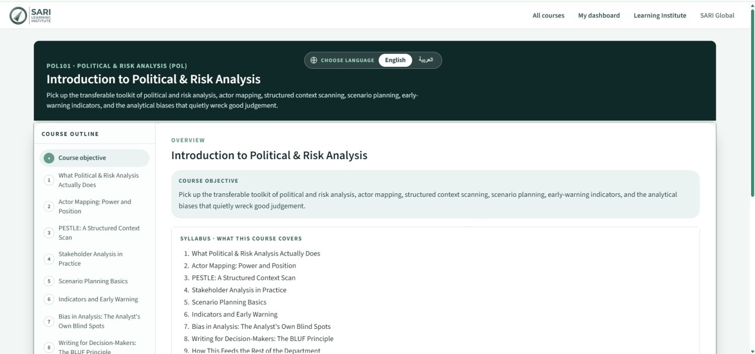
Syllabus, scenarios and quizzes on one screen.
Every course opens on its objective and syllabus, with the outline always visible. Lessons are short screens, and exercises such as sorting threats from vulnerabilities or building the management cycle sit between them.
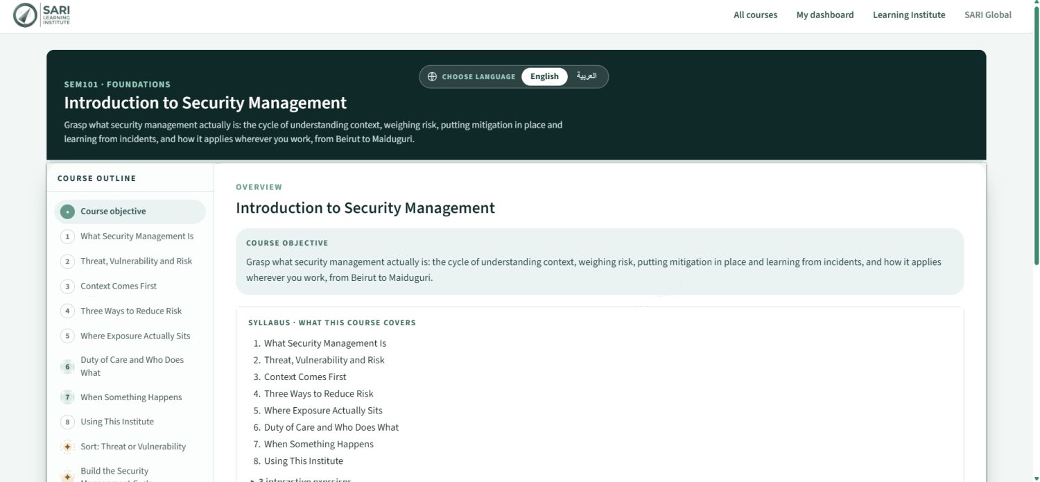
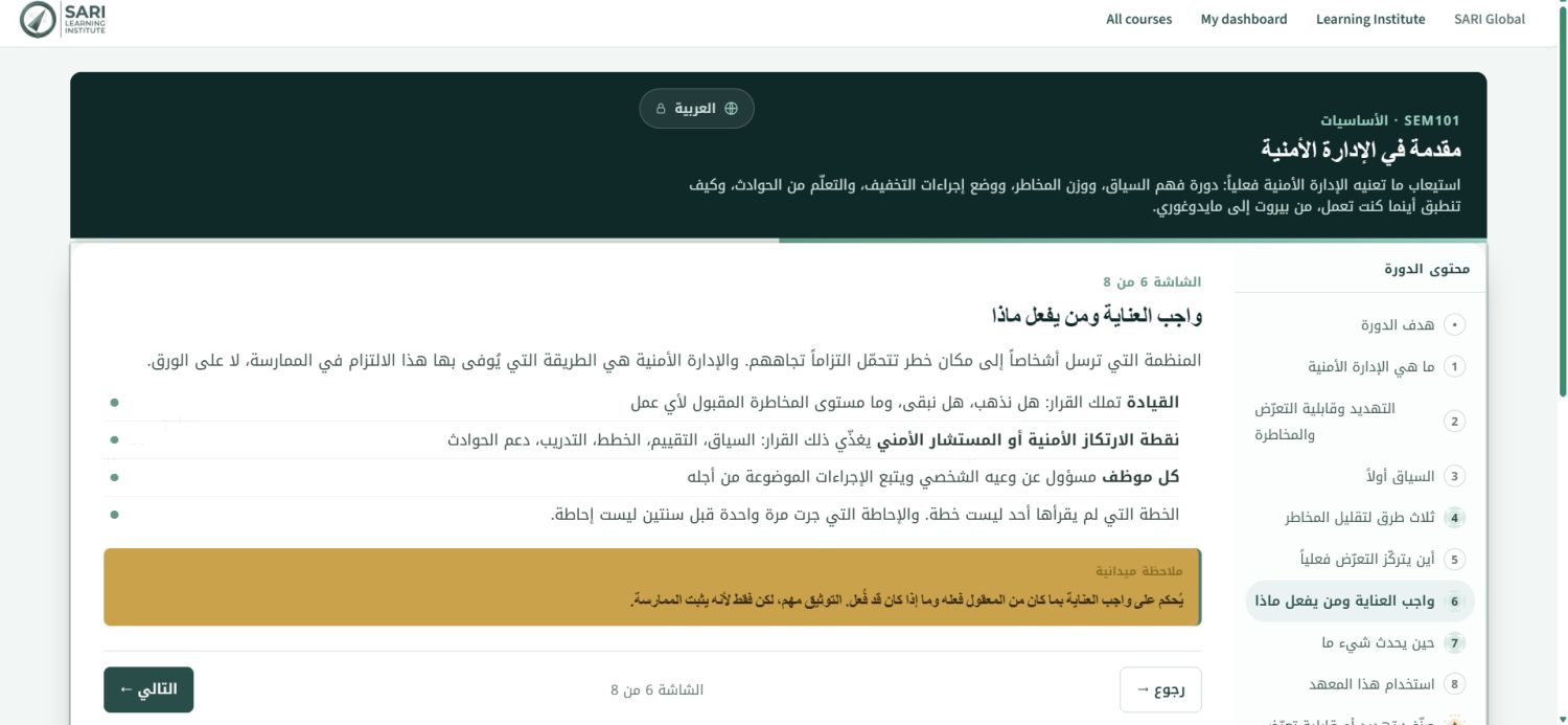
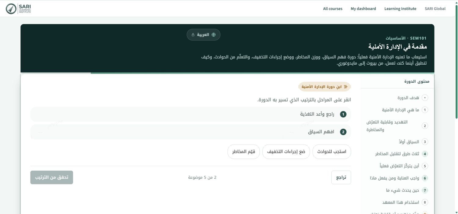
Introduction to Security Management
The security management cycle: context, risk, mitigation, and learning from incidents.
Civil Unrest
How crowds become lethal and how to operate safely through protests and riots.
CASEVAC
The casualty evacuation chain under hostile conditions: triage, movement and reporting.
Nigeria: Security Overview
A zone-by-zone security picture built on SARI incident monitoring data.
As-Sweida and Communal Violence Dynamics in Syria
Communal violence patterns and neutral, verified access in sensitive contexts.
South Lebanon: Border Conflict Awareness
The dominant threat pattern in the south: airstrikes, drones and artillery.
PMEL for Humanitarian Programs
OECD-DAC evaluation criteria, mixed-methods collection and moving from findings to recommendations.
Introduction to Political and Risk Analysis
Actor mapping, context scanning, scenario planning, early-warning indicators and analytical bias.
Conflict Zone and War Reporting
Journalists' legal status under international humanitarian law and the risks faced by local fixers and drivers.
HEIST
Hostile environment and individual safety for all staff: abduction survival, checkpoints, first aid, UXO awareness and digital security.
Security Management
Risk frameworks, contingency planning, incident management and SOP development for managers and country directors.
Crisis and Incident Management
Live simulations for senior management teams: scenarios, remote management, evacuation planning and recovery.
Operations and Occupational
Field safety for operational staff: journey management, vehicles, medical response, site assessments and radio procedures.
Training is tailored to each team's context and delivered in English, Arabic and French.
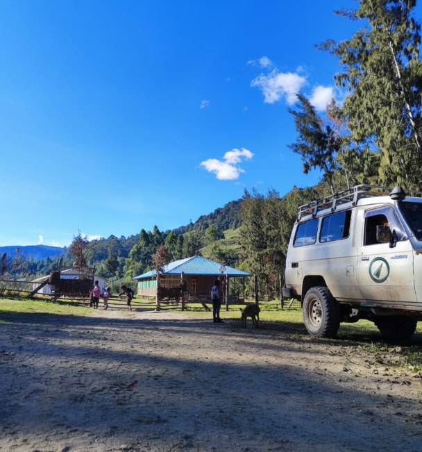
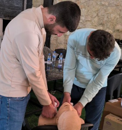
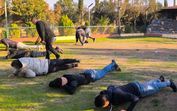
Training rooms and field roads.
The platforms are built from time spent on the ground. SARI teams train humanitarian staff hands-on and travel the same routes the reports describe.
Tools and early warning.
The same design system and data discipline carry across everything SARI ships.
Climate hazard layers
Live flood, drought, heat and water quality layers with published forecast products, and a Syria anticipatory action concept in development.
Safety and security signage
A bilingual English and Arabic pictogram system designed to become a shared standard on sites and vehicles.
3six5 staff tracking
Tracking for field teams, with an operations console and a staff app in the SARI design system.
In-country teams where it matters most.
Full coverage countries are staffed by SARI teams on the ground and feed the same GSOC and the same register. Regional coverage extends further, and countries are added as demand grows.
Request samples or start a trial
Reports are shared on request or through trial access rather than published openly. Tell us your area of operation and the products you need, or talk to the team.